
Maps of the Manor
During his lifetime, Andrew Barnett, a founder member of SLHS, meticulously plotted the boundaries of Sedgley Manor's nine villages based on the 1844 Tithe Survey. In 1990, Tom Bennett, a longtime friend, produced a sketch map showing the outer limits of the Manor and in 1991 Ron Baker refined this map.
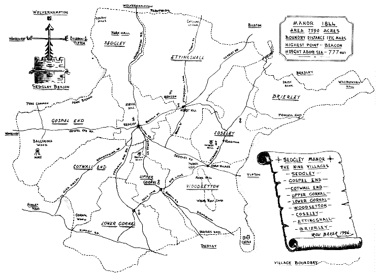
Finally in 1996 Ron Baker drew the classic map of the Ancient Manor of Sedgley, again based on Andrew's research. For clarification some more recent churches and roads were added, but the boundaries date from the original Survey.
Ron Baker's map is reproduced below.
If you are not familiar with the Manor's key position in the
Black
Country, check out the map on The Black
Country
Society's website.
Heritage Walks
Heritage Walk 1: Exploring the hamlet of Ruiton
The SLHS 2002/2003 season ended with over 50 people attending
a
guided walk around Ruiton - this page shows the route and highlights
some of the sites seen on the tour.
Map of the Nine Villages making up the Ancient Manor of Sedgley
Please click here if you wish to view the map in detail (opens in new window).
To see more of Ron's fine artwork, please visit our page focussing on Ron Baker's views of the Manor.