The cluster of buildings undergoing private restoration on the east side of Cooper’s Bank Road, very near to the junction with Himley Road, are situated at one of the most important historical places in the Manor - a Scheduled Ancient Monument.[There are only eight others in Dudley Metropolitan Borough]. Furthermore, Grade II listings have been given to the farmhouse & yard, barn, cart shed and stables.
On land to the east and south of the farm there is evidence of a medieval settlement. Buried and earthwork remains identify buildings, enclosures, hollow ways and ridge & furrow ploughing patterns all dated 1066 to 1260. Close by ‘New Park’ was created by The Earls of Dudley around 1250. The border of this deer park can be seen as a bank and ditch.
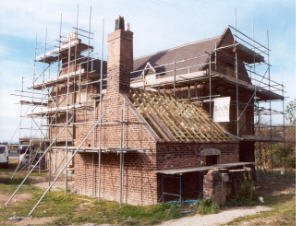
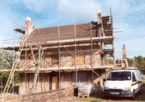
Some of the beams of the three storey farmhouse have been dated circa 1620 and it is possible that one of the Pers(e)house family, a name recorded in the Manor some 200 years earlier, could have owned the farm at this time.
Originally its lands would have been extensive and possibly included the present day, aptly named, Milking Bank housing estate. Located at the top of Cooper's Bank, nearly 500 feet above sea level, the owner would have had a good view of the distant pastures.
It was a working farm into the middle of the last century.
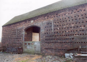
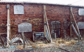
All the photographs were taken in October 2003. In order - rear of house, front of house, superb tithe barn with roosting holes and stables still requiring considerable attention.
Full details of Cooper's Bank Farm medieval settlement can be found here on the English Heritage PastScape site.