The east side of Cotwall End is dominated by the valley, although today the concept of a village in the vicinity will test imagination to the limits. Always a very rural part of the Manor, farms and cottages dotted the landscape. Even the name can be traced from a dwelling - 'Cote Waella End' - a cottage by the stream at the parish boundary. Furthermore, place names were often the early surnames. In the Record of Taxes for 1327 the name Adam de Cottewalle is listed.
The shape of the valley has markedly changed over the centuries due to the extraction of coal, clay, sandstone and limestone, but the scars have healed leaving an area rich in plant and animal life. As late as the 1950s open cast working for clay and coal took place. In 1972 its future was in the balance when a proposed housing development led to a public enquiry. The scheme was rejected and Dudley Council purchased the land and designated Cotwall End Local Nature Reserve in 1990. A ten year management plan was agreed in 2001 followed by the formation of a Friends group in the summer of 2004.
Five habitats have been identified - scrub, bog, lowland heath, grassland and ancient woodland. There are Sites of Special Scientific Interest and protected species - the great crested newt, kingfisher and badger. Over 300 plants have been recorded with grasslands rich in wild flowers and old mining spoil heaps invaded by heather.
Bob's Brook, the major watercourse, runs southwards through the 100 acres [56hectares] of the valley. In an earlier age its flow was dammed to make mill pools. Now a key feature of the Reserve, the stream meanders through the wooded Dingle and to the west of Turner's Hill wood on a journey to join the River Stour.
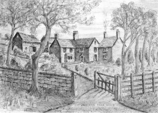
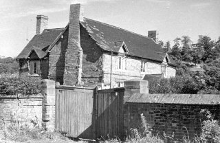
The print, by Ron Baker, and the photograph taken by Richard Dews show Cotwall End House and Conqueror's Farm. The former C17th building was at the top of the valley, the latter at the bottom. Both were lost to C20th 'progress' - the House in 1961 and the Farm a year later.
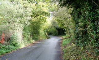
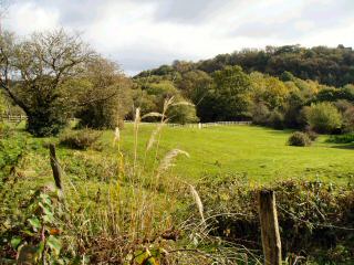
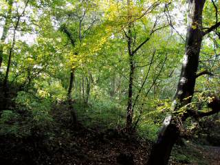
Photographs taken in October 2004 respectively show - Cotwall End Road from which the valley can easily be accessed, the tree lined eastern ridge and The Dingle a mature woodland spot, part of the Black Country Millennium Forest.
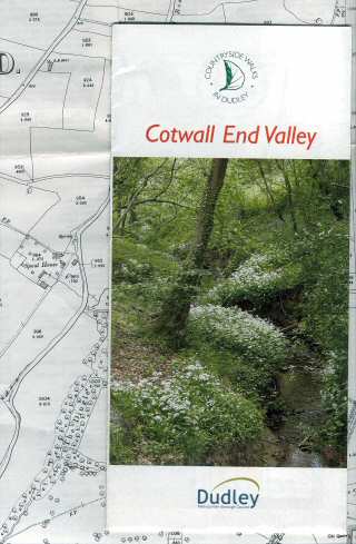
Finally a reminder to pick up the free leaflet, produced in 2003 by Dudley MBC and available from libraries. This is an excellent guide detailing a two hour walk and covering points of interest.
The valley is a rewarding experience at any time of the year. Visitors return again and again to this peaceful haven, one of the Manor's wildlife treasures.